Research articles in Web of Science
- Dornik A., Cheţan M-A., Drăguţ L., Iliuţă A., Dicu D.D., 2022, Importance of the mapping unit on the land suitability assessment for agriculture, Computers and Electronics in Agriculture (IF 6.757; AIS 0.932; Q1), 201: 107305, https://doi.org/10.1016/j.compag.2022.107305
- Dornik A., Cheţan M-A., Drăguţ L., Dicu D.D., Iliuţă A., 2022, Optimal scaling of predictors for digital mapping of soil properties, Geoderma (IF 6.114; AIS 1.122; Q1), 405:115453, DOI: 10.1016/j.geoderma.2021.115453
International conferences
- Dornik A., Cheţan M.A., Drăguţ L., Dicu D.D., Iliuţă A., 2022, Digital rating of land suitability to crops and land use in Romania, 22nd World Congress of Soil Science (WCSS 2022), 31 July – 5 August 2022, Glasgow, UK, https://22wcss.org/
- Dornik A., Cheţan M.A., Drăguţ L., Iliuţă A., Dicu D.D., 2022, Geographic Object-Based Image Analysis to delineate mapping units for land suitability assessment, The Fourteenth International Conference on Advanced Geographic Information Systems, Applications, and Services – GEOProcessing 2022, June 26-30, Porto, Portugal, https://www.iaria.org/conferences2022/ProgramGEOProcessing22.html
- Dornik A., Cheţan M.A., Drăguţ L., Iliuţă A., Dicu D.D., 2021, Optimal scaling of predictors for digital mapping of soil properties, The Thirteenth International Conference on Advanced Geographic Information Systems, Applications, and Services, GEOProcessing 2021, July 18 – 22, 2021, Nice, France, https://www.iaria.org/conferences2021/ProgramGEOProcessing21.html
- Dornik A.,Cheţan M.A., Drăguţ L., Dicu D.D., Iliuţă A., 2021, Importance of multiscale predictors for digital mapping of soil properties, THE 2nd INTERNATIONAL CONFERENCE: GEOGRAPHICAL SCIENCES AND FUTURE OF EARTH, GeoEarth 2021, November 22, Bucharest, Romania, http://geoearth.info/wp-content/uploads/2021/11/GeoEarth-2021-Conference-Programme-1.pdf
Digital application
One project deliverable is the digital application for evaluating and mapping land suitability to crops and land uses. The first version of the digital application, called Geospatial Land Suitability System (GeoLaSS), is currently in the publishing/patenting phase.
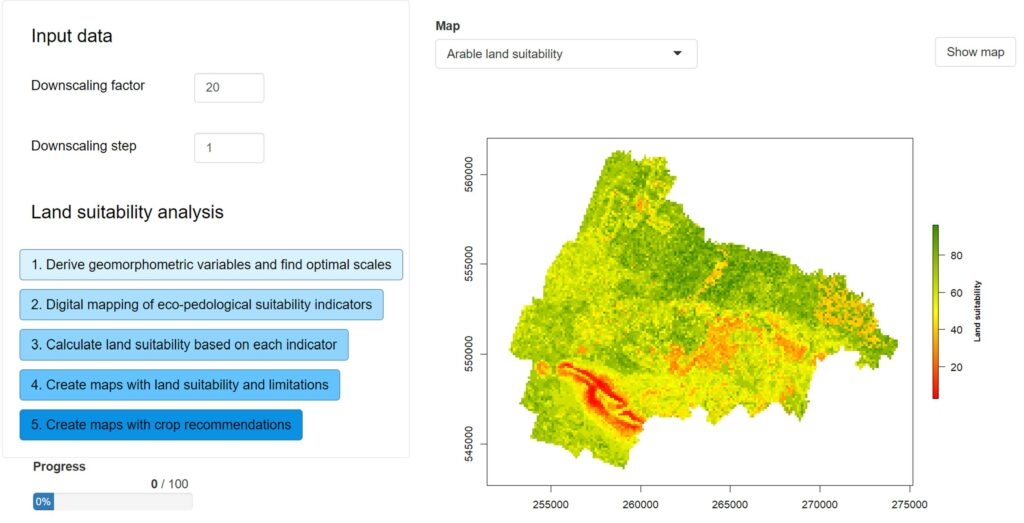
GeoLaSS graphical user interface
Project evaluation
The project results were evaluated according to the final evaluation and monitoring report with the maximum mark: EXCELLENT